The U.S. Army Corps of Engineers released a report Saturday detailing their proposed $52 billion plan to protect the New York City metropolitan area from storm surges and coastal flooding. It marks a major step forward in a long-delayed study initiated in the aftermath of Hurricane Sandy.
The Army Corps report provides significant new details for a proposal that was picked from a range of five options, as part of the NY & NJ Harbor & Tributaries Focus Area Feasibility Study (HATS). The tentatively selected plan, Alternative 3B, now proposes a 14-year construction project that would build 12 storm surge gates across some of the largest waterways around the New York City region.
It would also erect coastal barriers across more than 41 miles of the city’s shoreline, including extensive systems of seawalls and floodwalls in East Harlem, Lower Manhattan, southern Brooklyn, and the entire Rockaway Peninsula.
The Army Corps is soliciting public feedback on their report through January 6, 2023, in order to refine their proposal. It anticipates beginning its final designs for the plan in 2025 and starting construction in 2030. If approved, funded, and built, this proposal would create the largest and most comprehensive system of coastal protections in the region, while dramatically reshaping New York City’s waterfront.
A conceptual rendering of the Arthur Kill Storm Surge Barrier, from the new HATS report. Image courtesy of the U.S. Army Corps of Engineers.
A map showing the proposed plans for Alternative 3B, from the new HATS report. Image courtesy of the U.S. Army Corps of Engineers. Primary storm surge barriers are the largest measures in the plan. Induced flooding features would deal with potential flooding caused by the primary storm surge barriers diverting large columns of water. Risk reduction features are smaller, scattered measures in high risk areas, including smaller storm surge gates like those proposed in Howard Beach.
It would also be one of the largest infrastructure projects in the city’s history. The scale of the proposal is comparable to the $14.5 billion system of levees, flood gates and seawalls that the Army Corps built along 133 miles of New Orleans coastline, in the aftermath of Hurricane Katrina. In 2019, just 11 months after its completion, that system was deemed insufficient and in need of upgrades due to subsidence and rising sea levels.
The Army Corps initially expected to announce their tentative plan for New York in late 2019 or early 2020. But funding for the study was abruptly halted in February 2020, after then-President Donald Trump mocked its largest alternative on Twitter.
He described it as “a costly, foolish & environmentally unfriendly idea that, when needed, probably won’t work anyway.” The largest alternative considered was a $119 billion plan that included a five-mile storm surge barrier built across the mouth of the Lower New York Bay, stretching from Sandy Hook, New Jersey to Breezy Point, Queens.
The HATS study was quietly restarted in October 2021, under the Biden administration, and Alternative 3B was selected this July, after more than two years of delays.
Jamaica Bay with the Manhattan skyline in the distance. A storm surge gate is proposed for the entrance to the bay, as part of a new plan by the U.S. Army Corps of Engineers.
A conceptual rendering of the Jamaica Bay Storm Surge Barrier. Image courtesy of the U.S. Army Corps of Engineers.
The plan was selected based on a number of factors, including an evaluation of how it would protect the region from storm surges over a 50-year period. According to the report, Alternative 3B could reduce the economic damages caused by coastal storms from 2044 to 2093 by an average of $6.2 billion a year. The Army Corps expects storm surges in New York City to become more frequent and intense in the years ahead, due to climate change and sea level rise.
The environmental impacts of this proposal would potentially affect numerous ecosystems and wildlife species — with surge barriers and seawalls constructed in marine habitats, wetlands, beaches, and parks. The Army Corps report states the impacts on wildlife, fish, and endangered species would generally be low to moderate.
The largest environmental impacts are expected in the Jamaica Bay region, where the Army Corps rated the disruption on floodplains, wetlands and the parklands managed by the National Park Service as part of the Gateway National Recreation Area to be moderately high.
Environmental concerns
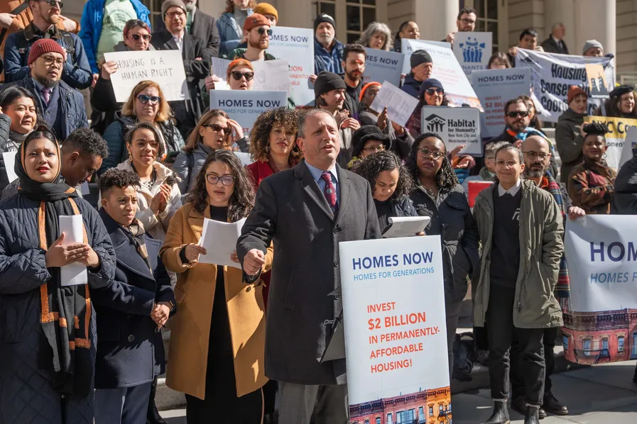
Several environmental groups, including the Natural Resources Defense Council, Riverkeeper, Gowanus Canal Conservancy, Guardians of Flushing Bay, and Newtown Creek Alliance, have expressed grave concerns about the barriers.
Riverkeeper, a non-profit working to protect the entire Hudson River watershed, has described the HATS study as “fatally flawed,” and said storm surge barriers would pose “a threat to the very life of the Hudson & Harbor.”
Hawtree Creek in Howard Beach, Queens. A storm surge gate is proposed at the mouth of the creek on Jamaica Bay, as part of a new plan by the U.S. Army Corps of Engineers.
These groups have raised questions about the destruction of marine habitats and migration routes — and the possibility that closing the gates during major storms would trap rainwater runoff, raw sewage, and other pollutants behind these barriers, causing flooding and pollution inland, in residential neighborhoods and parks.
Three of the waterways where storm surge gates are proposed are highly polluted Superfund sites, which are undergoing lengthy cleanups by the U.S. Environmental Protection Agency.
The Staten Island shoreline of the Arthur Kill, looking towards the Outerbridge Crossing. A storm surge gate is proposed south of here, as part of a new plan by the U.S. Army Corps of Engineers.
The Waterfront Alliance, an organization that works with a coalition of more than 1,100 waterfront organizations in the region, provided a statement about Alternative 3B to Gothamist.
“Waterfront Alliance is pleased to see the U.S. Army Corps of Engineers shift away from a storm surge barrier at the mouth of the New York-New Jersey harbor, to a more hybrid approach of green and grey infrastructure solutions,” said Tyler Taba, the Waterfront Alliance’s Senior Manager for Climate Policy. “We continue to echo our support for a phased approach that incorporates more natural and nature-based features. We particularly encourage a closer look at buyouts, restored natural areas, elevation or relocation of infrastructure, and non-physical nonstructural measures.”
What’s in Alternative 3B?
The 12 storm surge gates proposed by the Army Corps would be built in tidal straits and rivers across the city. They would be closed during major storms, protecting inland communities from the Atlantic Ocean. But these gates are not intended to protect against the gradual creep of sea level rise or inland flooding from heavy rainfalls, like the deadly floods caused by Hurricane Ida in 2021.
The largest gates currently proposed include a dual surge gate system on the Arthur Kill and the Kill Van Kull, two of the busiest shipping channels in the region — and a gate across the entrance to Jamaica Bay, a vast tidal estuary that is home to nature preserves and endangered salt marshes.
A conceptual rendering of the Kill Van Kull Storm Surge Barrier, from the new HATS report. Image courtesy of the U.S. Army Corps of Engineers.
Storm surge gates would also be built in New York at the mouths of Flushing Creek, Newtown Creek, Gowanus Canal, Sheepshead Bay, Gerritsen Creek, Shellbank Basin, Hawtree Creek, and at the head of Jamaica Bay, and in New Jersey on the Hackensack River. A tidal gate is proposed for the middle section of Coney Island Creek.
On shore, these gates would be connected to more than 31 miles of coastal defenses built across surrounding neighborhoods, including a system of levees, floodwalls and seawalls that would stretch over 22 miles from Bath Beach, Brooklyn to Far Rockaway, Queens. The plan also proposes constructing walls, elevated promenades, and flood barriers along 5.7 miles of shoreline in Lower Manhattan, 4.7 miles in East Harlem, and 8 miles in Jersey City.
The Staten Island shoreline of the Kill Van Kull — with Bayonne, New Jersey in the distance. A storm surge gate is proposed here, as part of a new plan by the U.S. Army Corps of Engineers.
While Alternative 3B was not the largest proposal considered by the Army Corps, it is, by far, the largest system of coastal barriers proposed for the city. The Army Corps is also currently building coastal defenses along the waterfront of the Rockaway Peninsula and has begun its initial work on a 5.3 mile-long shoreline barrier in Staten Island.
Other large projects currently underway in the city include the Governor’s Office of Storm Recovery’s Living Breakwaters in Staten Island and the city’s East Side Coastal Resiliency (ESCR) Project in Manhattan. Each of these projects protects a relatively small portion of the city’s waterfront, compared to the Army Corps latest proposal.